
MILFOIL
WHAT IS MILFOIL?
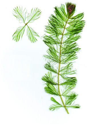
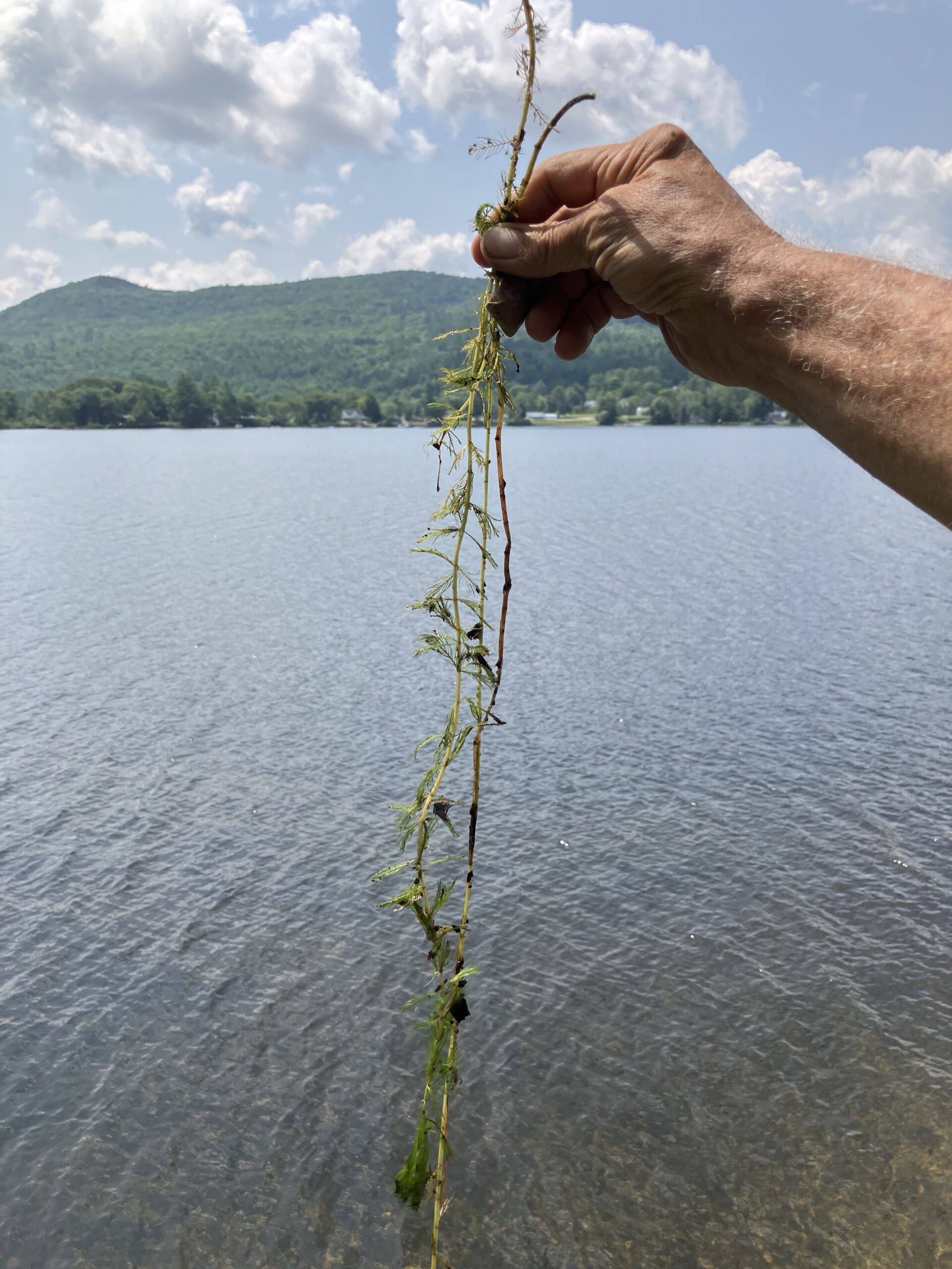
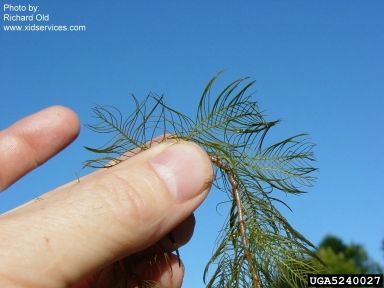
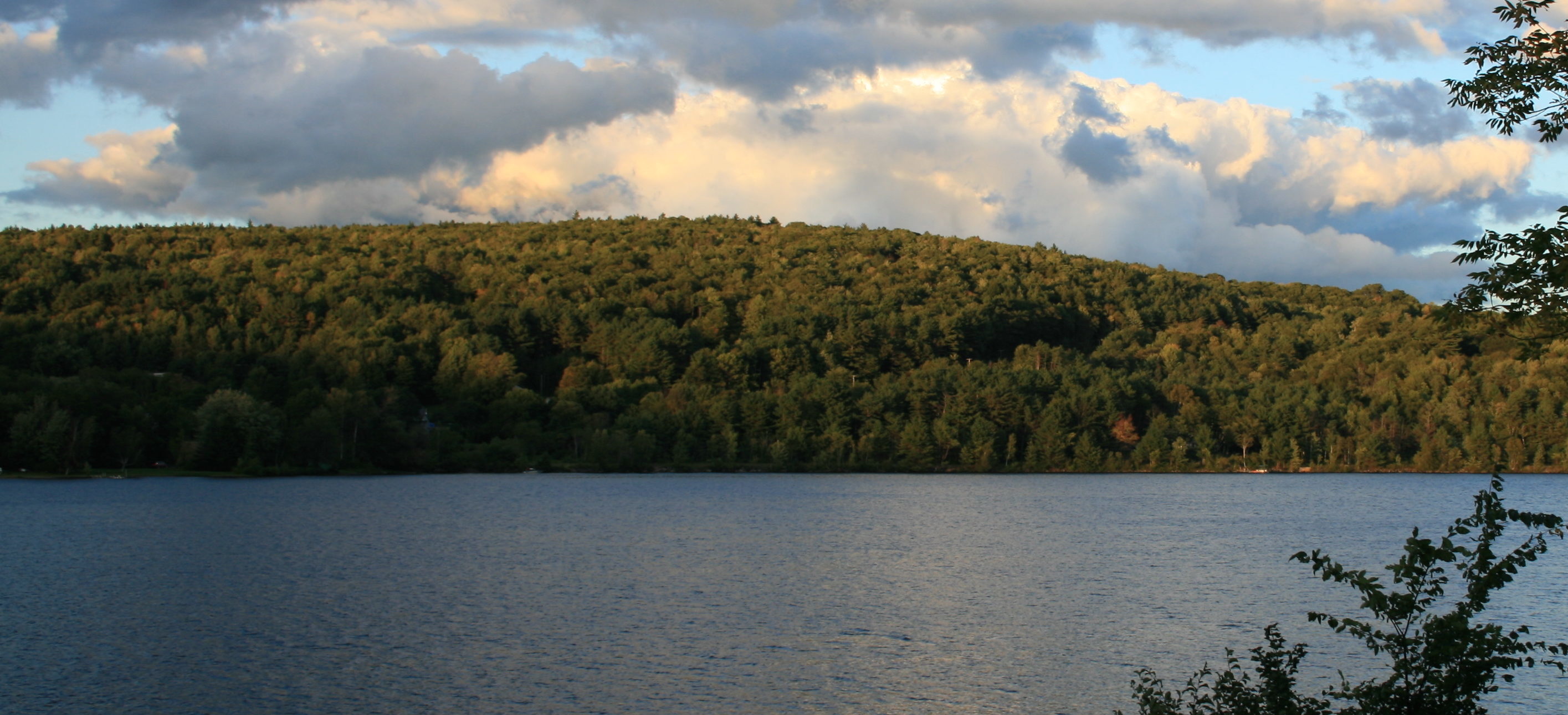
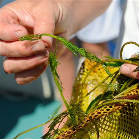
Eurasian milfoil (Myriophyllum spicatum) is an invasive aquatic weed first discovered in Mascoma Lake in 1997. In our waters, milfoil has no natural predators to keep its population in check. It also has aggressive survival strategies. Under optimum temperature, light, and nutrient conditions, plants may grow up to an inch per day. If broken, stem and root fragments can float away to establish new plants. Milfoil can also live out of water for many hours if it remains moist.
When it is not controlled, milfoil forms dense stands of vegetation in the water, with thick mats at the surface that shade out native plants and reduce oxygen levels, harming both fish and water quality. Severe disruption of recreational activities follows: swimming can be unpleasant and boating nearly impossible. Milfoil can ruin lakes.
Mascoma has escaped this fate thanks to the volunteer program founded by the late Bill and Nancy Martin, Karen Hambleton, Roger and Marta Barnes, and other pioneers in 1997. For a detailed history of this effort, see Milfoil Recollections.
CONTROLLING MILFOIL
The key to successful milfoil control has been steady vigilance and dedicated volunteer participation. We do not expect to eliminate this invasive weed; it’s too tenacious. Even so, we have significantly reduced the infestation over time. (See charts below.) We have never used the expensive chemical treatments or suction harvesting methods other lakes have turned to when infestations get out of control. Instead, we conduct a form of specialized underwater hand weeding to remove plants without fragmenting and spreading them further.
CONTROL OPERATIONS
SEARCH
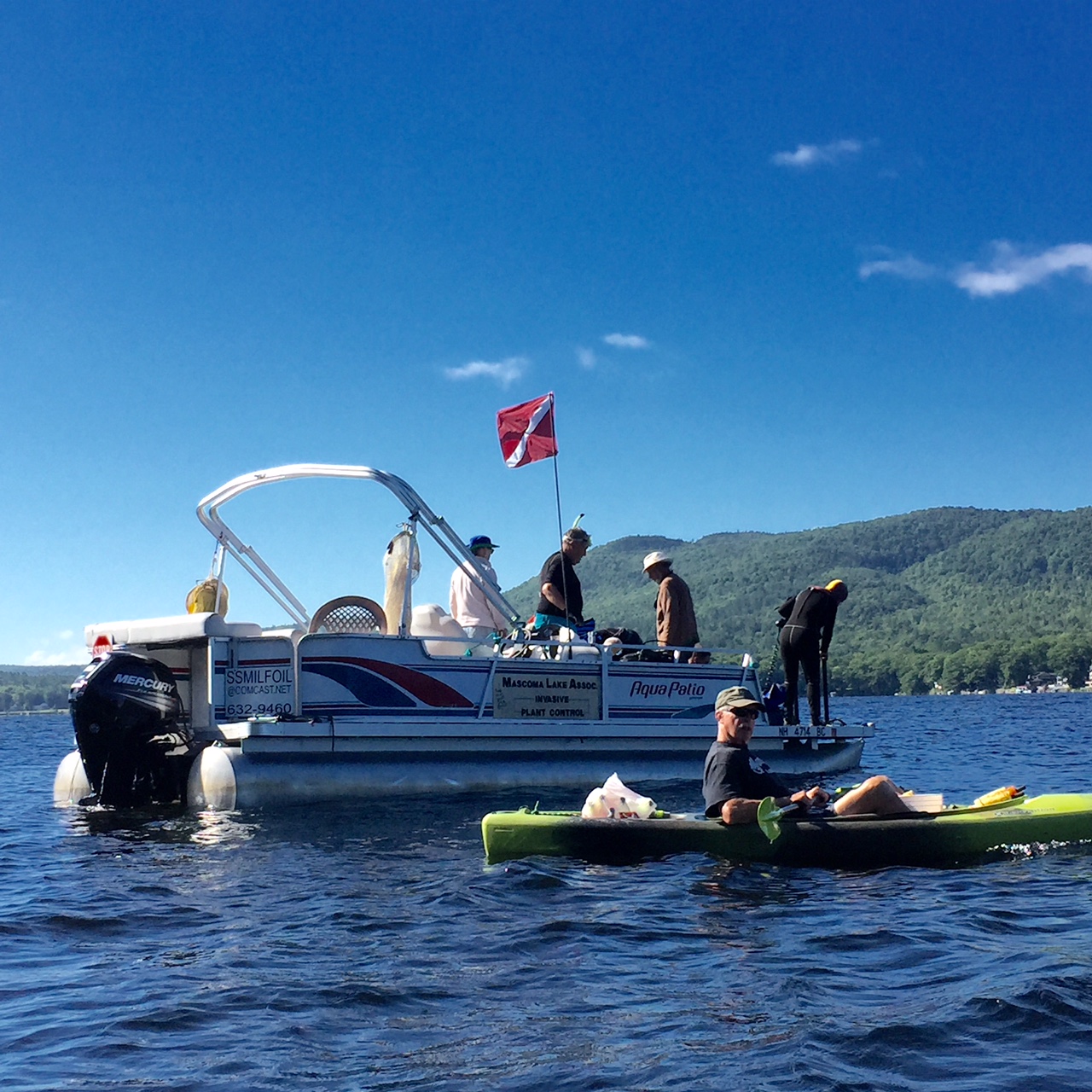
From June to September, our barge “S.S. Milfoil” patrols the water looking for the distinctive feathery stalks of Eurasian milfoil. When we find plants, we drop weighted orange-yellow markers made from foam noodles. Local residents also monitor areas near their homes, place markers, and report to us when they spot plants.
Several times each summer, we conduct “synchronized swim” searches, with lines of snorkelers scanning for plants on the lake bottom in areas with historically high plant counts. We also use GPS technology to keep track of harvest locations, which increases search efficiency.
HARVEST
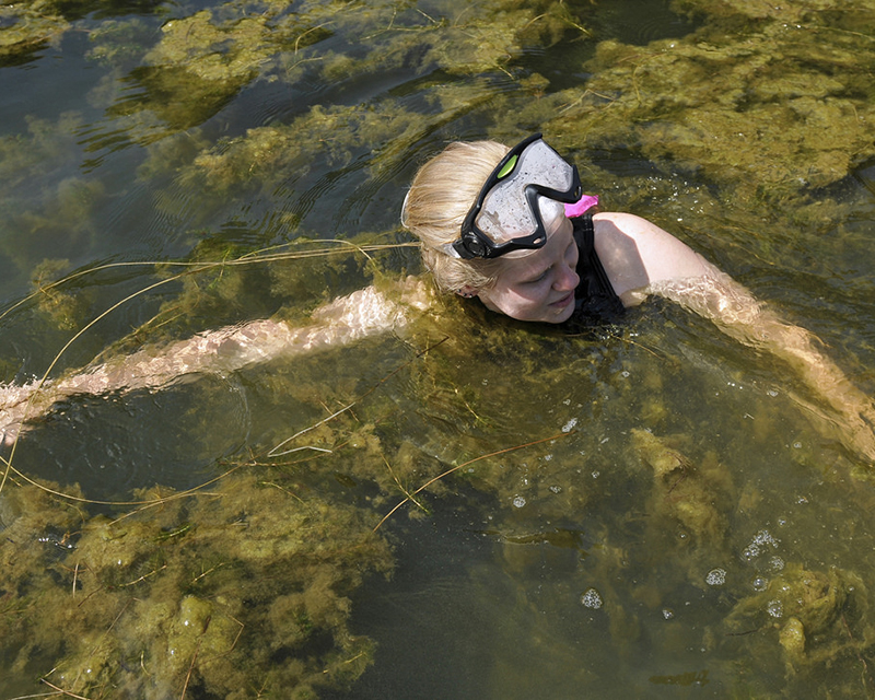
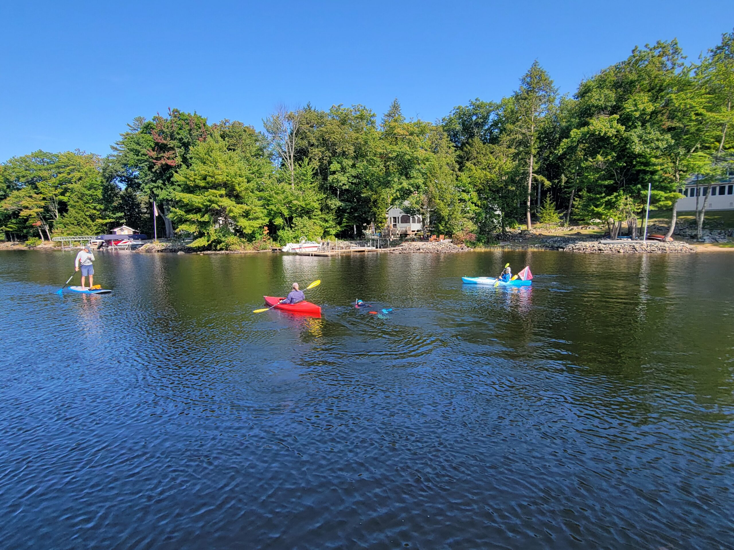
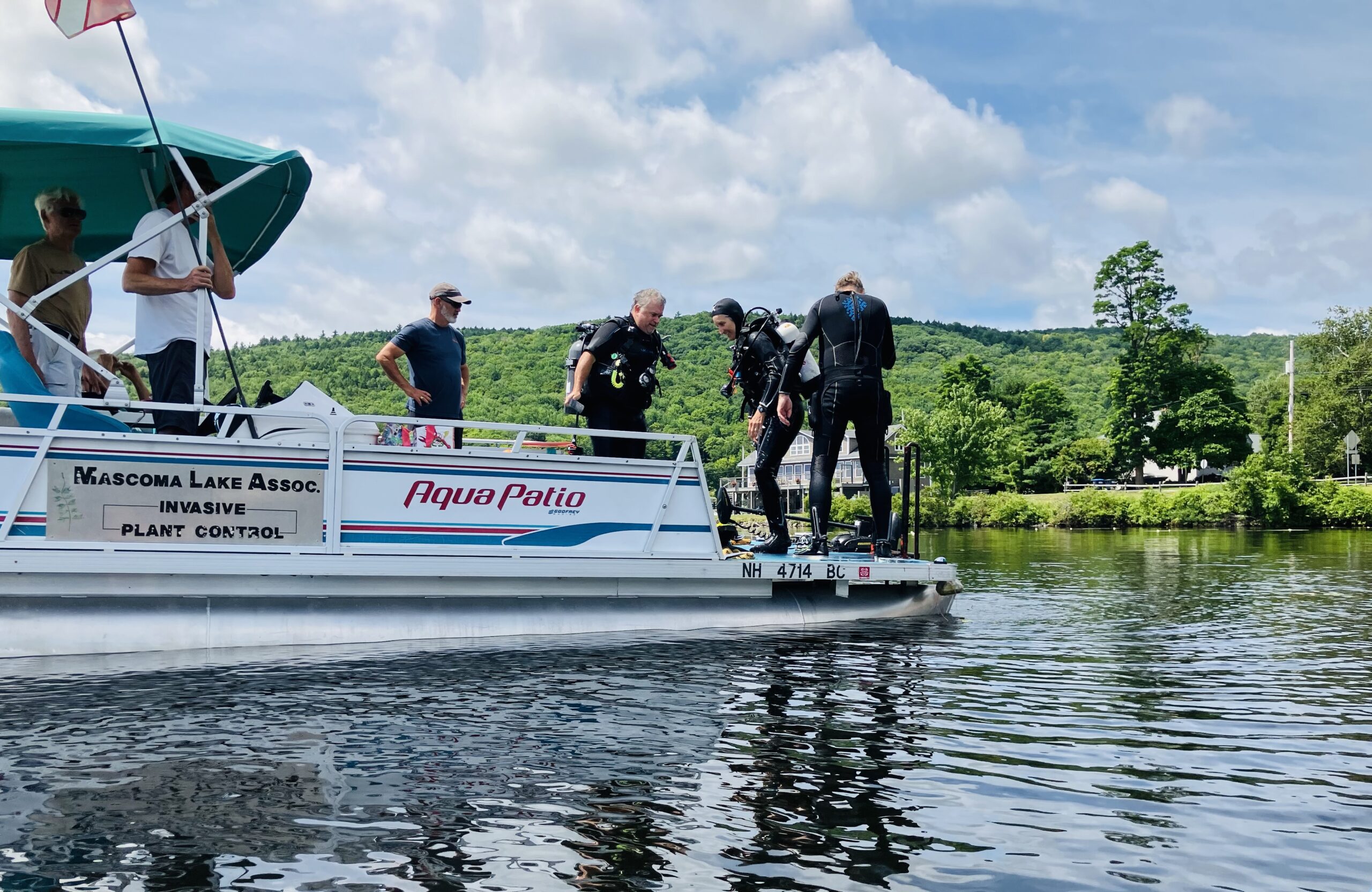
The key operation is harvesting. Certified weed control divers— SCUBA-certified volunteers who have completed a special state-approved course—dive and remove each individual plant by hand. The process is tedious, but it’s essential to remove every fragment of every plant. While divers are removing plants under the water, support volunteers are watching the water surface, collecting the harvested weeds and recording counts, keeping divers supplied with new collection bags, and using nets to remove any plant fragments that are floating.
EQUIPMENT
The “SS Milfoil” is the most important equipment in the program. It’s a working barge on a pontoon base, owned and operated by the Mascoma Lake Association. Our VLAP team uses it to collect water samples, but its primary function is serving as the platform for divers during harvest trips. The barge has both a gasoline motor and an electric one that allows slow, wakeless movement.
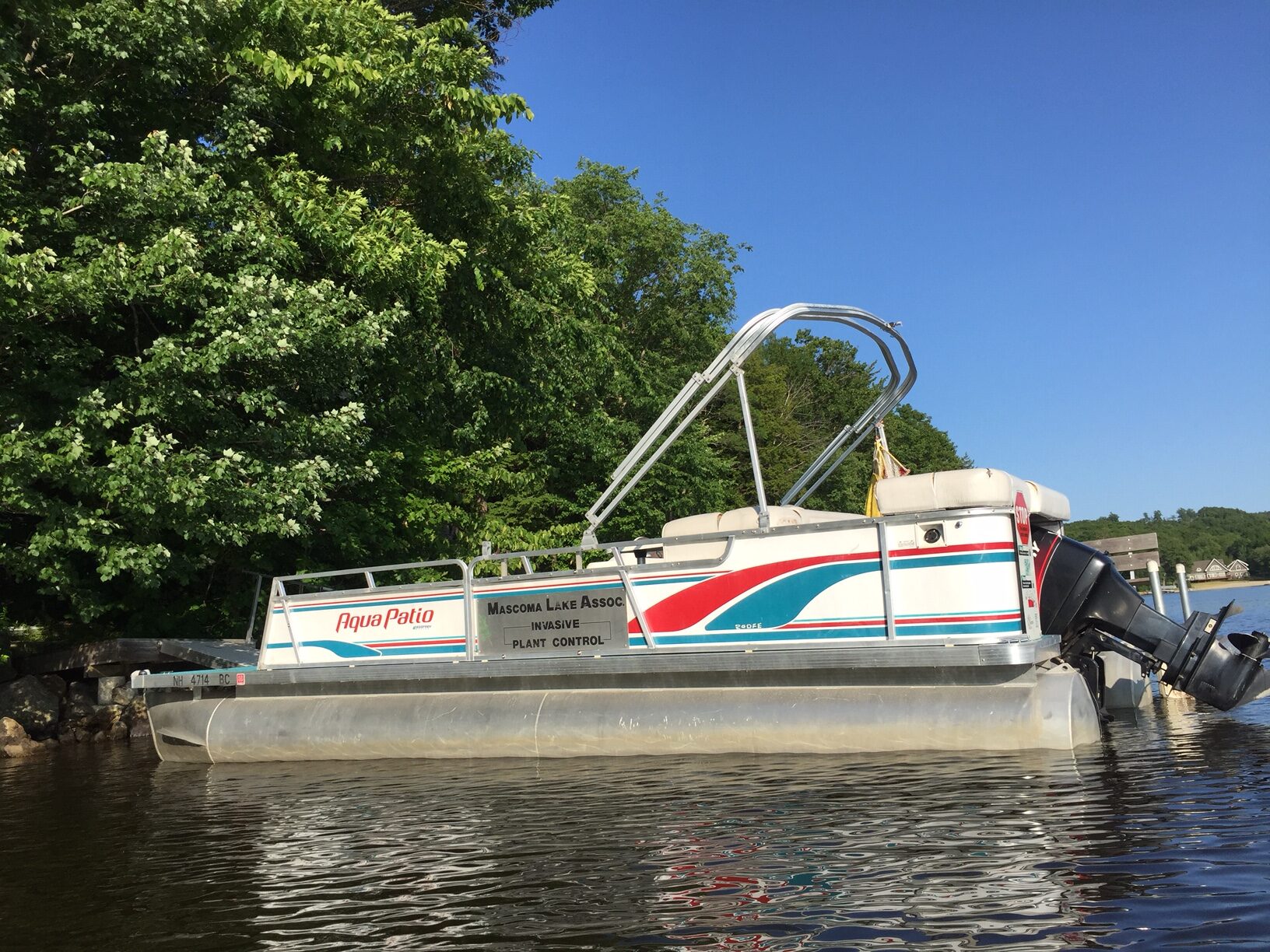
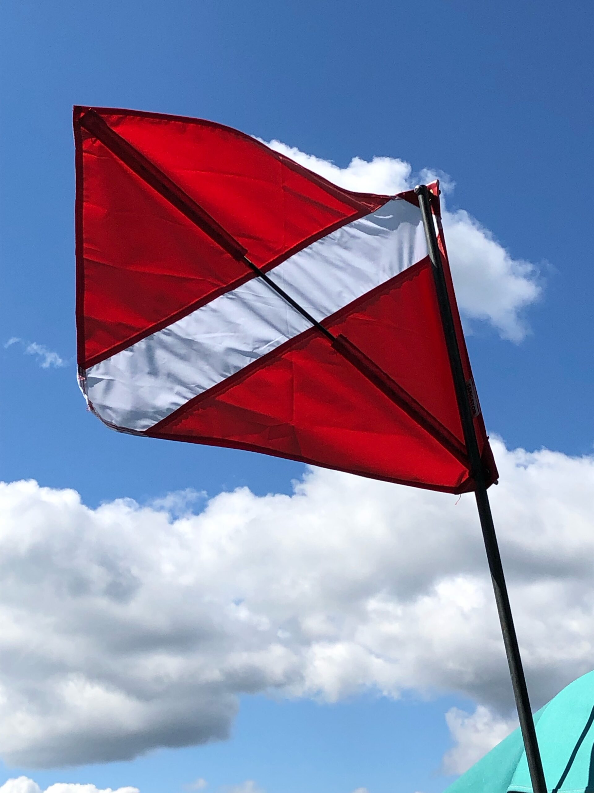
If you see the SS Milfoil out on the water, please feel free to greet us and see what we’re doing—unless our dive flag is out. It signals that divers are active in the water, and you probably can’t see them. If you see the flag, steer wide away from the barge.
PREVENTION
Eurasian milfoil probably arrived in our lake three decades ago as a “stowaway” fragment attached to a boat or trailer. This means that preventing its renewed entry is as important as annual control of the plants that already grow here. The MLA Lake Host Program is dedicated to this deterrence — not only for Eurasian milfoil but for other invasive plants and aquatic life infesting water bodies in our region.
We need to keep milfoil down and out in Mascoma Lake.
HOW YOU CAN HELP CONTROL MILFOIL
◉ If you see an orange-yellow foam-noodle milfoil marker, please leave it where it is and avoid motorized boating near the marker.
◉ Clean off your boat! Here’s a video of Cheers’ Cliff Clavin (John Ratzenberger) discussing how to clean Milfoil off your boat by Minnesota Sea Grant.
◉ If you think you see Eurasian milfoil, let us know and we’ll follow up on suspected sightings. You don’t have to be an aquatic plant expert, just an alert citizen!
◉ If you would like to monitor the water near your property on a regular basis as part of the “neighborhood water watch,” let us know. Your commitment as a watcher would be to cruise your area from the shoreline to a depth of 12-14 feet when the lake is still and the sun is not directly overhead (usually early morning or late afternoon). We ask that you report at least once by July 15 and a second time by the middle of August. We particularly need weed watchers on the 4A side from the Baited Hook to the head of the lake.
◉ If you’re a SCUBA diver or want to become one, we welcome new divers. With the state-approved training, it’s easy to learn the techniques of proper milfoil harvesting.
◉ We also need people to become surface support crew on the SS Milfoil. Support volunteers accompany the captain and the divers on each harvesting trip. They clean collection bags, count plants, and record harvest locations on our GPS.
◉ Learn about setting up milfoil markers for harvesting milfoil.

MILFOIL HARVESTING DATA
MILFOIL HARVEST RECORD 2013-2022
This chart indicates the dramatic drop in plants harvested after 2015. That was the year we began underwater searches with teams of snorkelers, a technique that allows us to harvest small plants well before they become visible at the surface.
After ten years, some areas of the lake that were heavily infested in the past are clear of milfoil.
MILFOIL HARVESTING TRIPS
| start-July 4 | July 5 – 28 | July 29 – Aug 20 | Aug 21 – End | Total | |
| 2012 | 6 | 6 | 5 | 6 | 23 |
| 2013 | 3 | 9 | 4 | 11 | 27 |
| 2014 | 2 | 4 | 3 | 8 | 17 |
| 2015 | 2 | 11 | 8 | 8 | 29 |
| 2016 | 3 | 6 | 6 | 6 | 21 |
| 2017 | 5 | 6 | 6 | 6 | 23 |
| 2018 | 8 | 3 | 5 | 9 | 25 |
| 2019 | 0 | 3 | 2 | 3 | 8 |
| 2020 | 4 |
This chart shows how many trips were taken each year (broken into quarters), with the total for each season shown in the right-hand column. The average for the first six years is 23.
In 2015, when the number of harvested plants was highest, there have more trips than average, but not enough to explain the larger harvest. (For trips alone to account for the spike in harvest that year, we would have needed to take more than 51 trips.) Since 2015 we seem to have returned to average numbers of trips but the harvest has dropped off precipitously in recent years as shown in the Harvest chart. In other words, we’ve kept looking as hard as before, but we find many fewer plants.
MILFOIL PLANT INTENSITY 2012-2020
| 2012 | 2013 | 2014 | 2015 | 2016 | 2017 | 2018 | 2019 | 2020 | |
| # Markers | 172 | 203 | 180 | 358 | 358 | 112 | 226 | 23 | 5 |
| # Plants | 2042 | 3059 | 2305 | 5454 | 2393 | 734 | 740 | 49 | 11 |
| Plants per Marker | 11.87 | 15.07 | 12.81 | 15.23 | 6.68 | 6.55 | 3.27 | 2.13 | *2.2 |
This chart shows that up through 2015, the number of plants per marker was much higher, at an average 13.75 plants per marker. The average began to drop after that, showing a significant reduction in milfoil intensity.
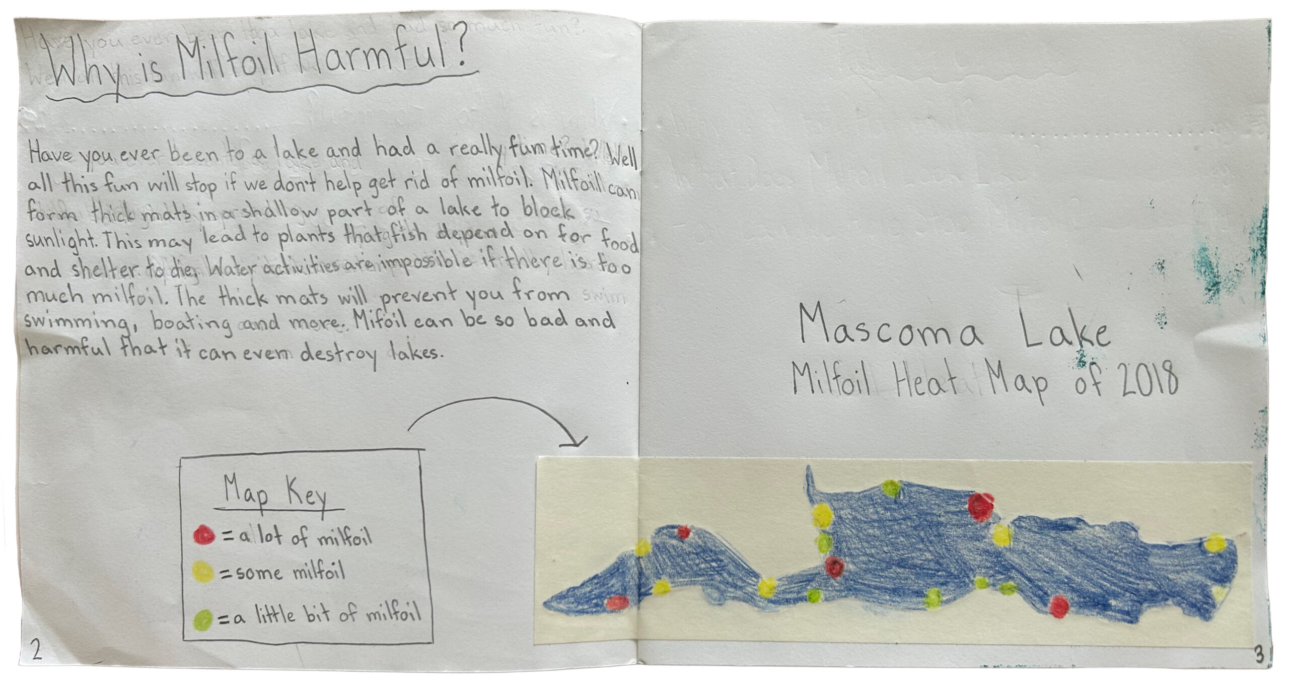
MILFOIL DATA MAPS 2013-2018
Unfortunately, in 2018 Google discontinued support for their wonderful application that worked with Google Maps and data supplied by the user to create interactive maps of the individual harvest sites or heat maps indicating the intensity of the harvest areas. Before they discontinued this application we took screen shots of several years’ harvests shown as heat maps. We are continuing to explore other applications that might allow us to resume sharing harvest data in an easily comprehensible visual representation, but for now, click below to see heat maps from 2013 to 2018.
Heat Map 2018
Heat Map 2017
Heat Map 2016
Heat Map 2015
Heat Map 2014
Heat Map 2013